

Quick answer
Edinburgh to highlands by car takes between two and four hours depending on your destination and chosen route. Fort William lies 210 kilometres via the A82 through Glencoe, while Inverness sits 250 kilometres north via the A9 through Cairngorms National Park. Public roads throughout the Highlands are free to access year-round, though fuel, parking and any attraction stops carry separate costs.
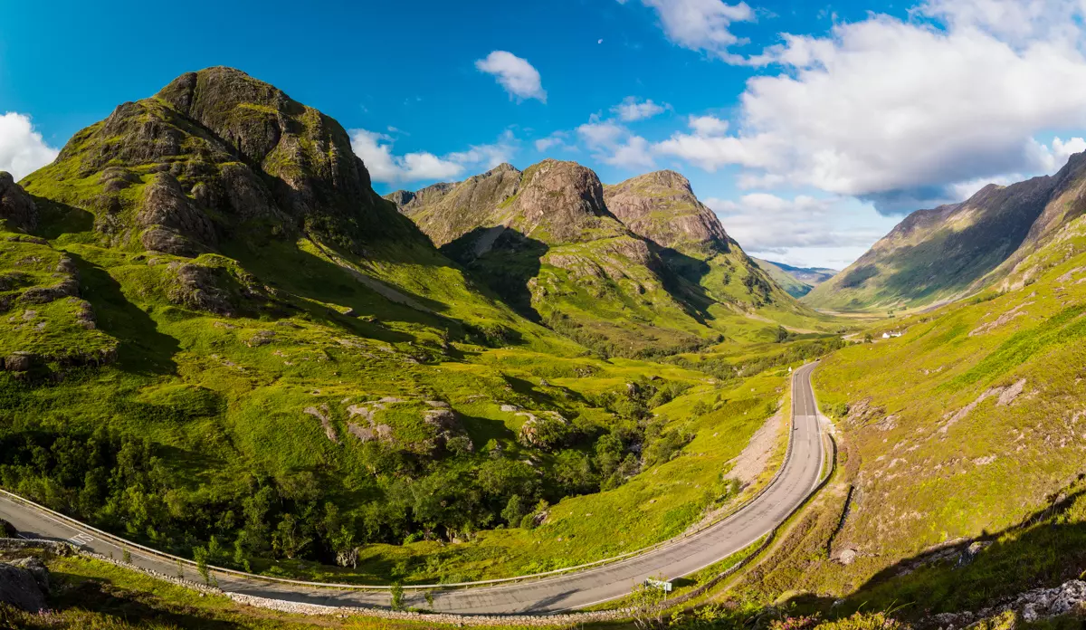
The Highland Boundary Fault runs in a diagonal slash from Helensburgh to Stonehaven, and crossing it by car marks the transition from Scotland's Central Belt into genuine mountain terrain. Most drivers departing Edinburgh choose between two primary arteries: the A9 corridor pushing north through Perth and Pitlochry toward Inverness, or the A82 route threading west past Loch Lomond and into Glencoe. Both roads remain open throughout the year, though winter snowfall between November and March frequently closes high passes for hours at a time. Driving Edinburgh to the Highlands by car grants access to landscapes that defined Scottish Romanticism and shaped Victorian tourism. The A82 traces the geological rift of the Great Glen, where glacial valleys carved troughs now filled by Loch Loness and Loch Ness. Glencoe's volcanic ridge, site of the 1692 massacre, forms a natural bottleneck that funnels all westbound traffic through a single-track gauntlet. The A9, by contrast, climbs the gentler eastern flank of the Grampian Mountains, passing Blair Atholl and the Drumochter Pass at 450 metres elevation, the highest point on the British trunk road network. Petrol stations thin out north of the Highland line. Callander, Pitlochry and Fort Augustus serve as the last reliable fuel stops before extended moorland stretches. Single-track roads with passing places dominate the western Highlands, requiring drivers unfamiliar with British road etiquette to learn the protocol of yielding to uphill traffic. Mobile signal drops entirely across Rannoch Moor and in the deeper glens, making offline maps essential. Hiring a vehicle in Edinburgh gives you control over departure times and the freedom to detour toward Cairngorm reindeer herds or the Commando Memorial above Spean Bridge, both invisible to coach tour itineraries. The drive itself becomes the attraction once you pass Callander. Ben Lomond rises abruptly west of the loch, its pyramidal silhouette recognisable from nineteenth-century engravings. Autumn brings red deer onto the verges during the rutting season, and low-angle September light turns the heather slopes copper. Plan fuel, check road status on Traffic Scotland, and accept that Highland weather changes faster than any forecast predicts.
“The Highland Boundary Fault runs in a diagonal slash from Helensburgh to Stonehaven, and crossing it by car marks the transition from Scotland's Central Belt into genuine mountain terrain.”
The Best Arrival Window for Driving Edinburgh to Highlands by Car
The best arrival window for driving from Edinburgh to the Highlands is 08:00–10:00. This timing allows drivers to bypass city commuter traffic and arrive at key Highland locations before peak tour bus arrivals.
May and September
ModerateMild, 10°C to 16°C
These shoulder months offer balanced weather and manageable traffic levels. Daylight hours remain sufficient for extended driving routes.
June to August
HighWarm, 12°C to 19°C
Peak summer travel sees the highest volume of visitors. Expect crowded parking areas at popular viewpoints throughout the day.
October to April
LowCold, 1°C to 9°C
Visitor numbers decrease significantly during winter months. Shorter daylight hours require careful planning of driving segments.
Weekday mornings
Low to Moderate—
Departing during this window avoids the heavy congestion of daily city work commutes. Mid-week travel typically results in fewer vehicles on narrow Highland roads.
Verdict: The most effective strategy is departing on a Tuesday, Wednesday, or Thursday between 08:00–10:00 during the months of May or September.
Navigating the Route: Edinburgh to Highlands by Car
The Scottish Highlands are located to the north of Edinburgh, typically accessed by exiting the city via the Queensferry Crossing. The primary arterial routes connect directly to the A9 or the A82, which serve as the main gateways into the Highland region.
M90 and A9 via Perth
M9 and A82 via Stirling
Planning Your Edinburgh to Highlands by Car Itinerary
A flexible route plan for drivers who want to experience the Highlands at their own pace. Most visitors choose a day trip to Loch Lomond or Glencoe (2-3 hours each way), or a multi-day circuit covering the North Coast 500 or Skye.
Loch Lomond & The Trossachs
Drive 1 hour 15 minutes north from Edinburgh to reach Loch Lomond's southern shores. Stop at Luss village or the Trossachs viewpoints before continuing deeper into the Highlands.
Glencoe Valley
Add 1 hour 15 minutes from Loch Lomond to reach Glencoe's dramatic valley floor. Park at the Three Sisters viewpoint or walk part of the Lost Valley trail if weather permits.
Fort William or Inverness
Fort William lies 30 minutes beyond Glencoe; Inverness is 2 hours northeast and serves as a natural overnight base. Both cities offer fuel, accommodation, and onward routes to Skye or the northern coast.
Overnight in the Highlands
If staying multiple days, use Inverness or Fort William as a hub for loops to Loch Ness (30 minutes), Skye (2-3 hours), or the North Coast 500. Single-day visitors should allow 4-5 hours for the return journey to Edinburgh.
Edinburgh to Highlands by Car: Costs and Access Fees
Driving from Edinburgh to the Scottish Highlands does not require an entry fee for road usage. Access to public routes throughout the region remains open to all travelers without charge.
A typical adult pays 0 GBP for road access, though costs may arise from fuel, vehicle rental, or private parking fees.
Common Mistakes When Driving Edinburgh to Highlands by Car
First-time drivers to the Highlands often misjudge journey conditions and infrastructure gaps. These errors turn straightforward drives into stressful detours.
Skipping fuel stops after Edinburgh
Petrol stations thin out north of Stirling. Fill up in Pitlochry or Aviemore; some routes have 50+ mile gaps between pumps.
Ignoring single-track road protocols
Pull into passing places only when they're on your left, or wait opposite if on your right. Let faster traffic overtake and never reverse long distances.
Underestimating Highland driving times
100 miles takes 2.5–3 hours, not 90 minutes. Narrow roads, livestock, and 60 mph limits slow progress considerably.
Relying solely on sat-nav in remote areas
Mobile signal drops in glens and mountain passes. Download offline maps and carry a paper road atlas as backup.
Driving in poor visibility without preparation
Highland weather shifts fast. Pack warm layers, snacks, and a torch; mist can reduce visibility to metres within minutes.
Essential Checklist for Edinburgh to Highlands by Car Trips
A Highland road trip requires advance vehicle preparation, reliable navigation tools, and emergency provisions for remote terrain.
-
Check fuel, oil, coolant, and tire pressure — Highland petrol stations can be 40+ miles apart, and mobile signals drop in glens.
-
Download offline maps for Google or Apple Maps — Mobile coverage vanishes between Glen Coe and Fort William, leaving you reliant on cached data.
-
Pack torch, blanket, water, and snacks — Single-track roads mean breakdowns leave you exposed for hours before recovery.
-
Confirm car hire includes breakdown cover — RAC and AA Highland callouts average 90 minutes; verify your policy covers remote recovery.
-
Load Scottish road atlas or OS maps — GPS satellites lose accuracy in steep glens; paper backup prevents route errors.
-
Top up screenwash and carry de-icer — Highland weather shifts rapidly; frost forms on windscreens even in May mornings.
Check availability
Frequently asked questions about edinburgh to highlands by car
Everything you need to know about edinburgh to highlands by car